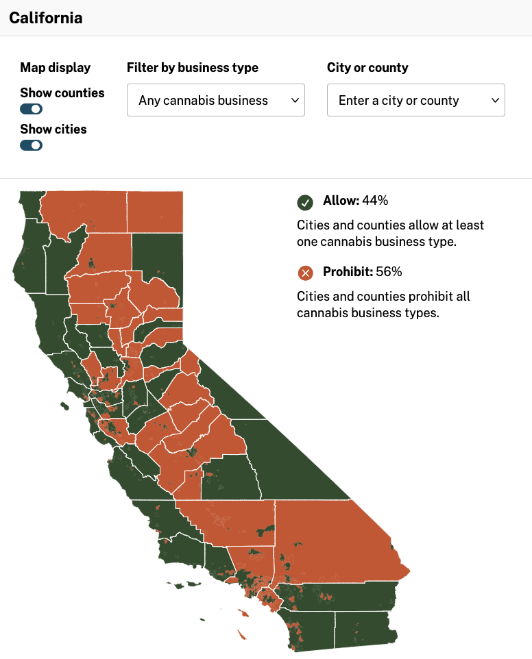

California officials launched a new resource on Thursday, providing people with an interactive map showing where marijuana businesses are permitted—and where they are blocked from opening—throughout the state.
The tool draws attention to the fact that more than half of the state’s cities and counties do not allow any type of cannabis licensees to operate in their area, which advocates say is a problem that has allowed the illicit market to thrive despite voter-approved legalization.
The interactive map shows 44 percent of cities and counties allow the licensing of at least one cannabis business type, while 56 percent of cities and counties prohibit the licensing of all cannabis business types. #CAcannabis #Map
— CA Department of Cannabis Control (@CAcannabisdept) May 26, 2022
The map from the Department of Cannabis Control (DCC) doesn’t identify where to find dispensaries that are open, per se (though the agency does have a separate online resource where consumers can find individual licenses businesses). But the new tool does break down how many cities in a given county allow retailers, distributors, manufacturers, cultivators and testing facilities.
“This data helps Californians understand the work we have ahead of us in realizing the promises of cannabis legalization,
Read full article on Marijuana Moment
